Saab's reach into space

Space is the final frontier for humanity and Saab believes it could also be a major driver of growth and investment in Australia. The company is a founding member of the Cooperative Research Centre for Innovative Space Solutions and is looking to apply its situational awareness technology to satellite systems and data.
Saab has both spin-off companies and core technologies in the space domain. The spin-off is the Vricon GEOINT Data Suite, which provides geospatial analytics and visualisation on a global scale. Originally a product of our Dynamics division the technology uses stereoscopic imaging techniques, originally developed for missile seekers, to create high quality 3D models of cities, towns and terrain.

The Vricon rapid 3D mapping system.
The Vricon system is unique in its ability to rapidly produce high-resolution 3D data for large areas of interest based on aerial imagery from manned aircraft, UAVs or satellites. A recent example is the Natanz nuclear facility in central Iran, now a world focal point. To detect temporal terrain changes, two Vricon 3D data sets were produced based on DigitalGlobe WorldView-1 and WorldView-2 satellite imagery collected one year apart. A total of five images were used to process that data which was built without digital elevation data or ground control points. The intent was to analyse geospatial changes and estimate the size of underground construction based on the calculated volume of landfill sites.
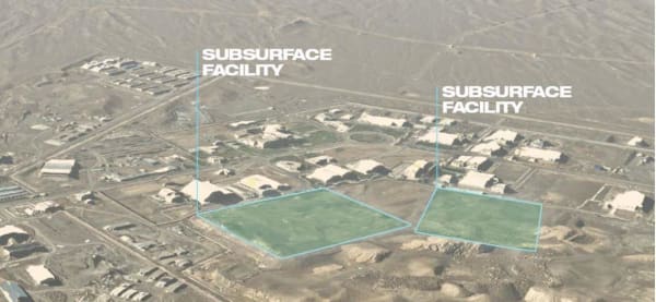
Nuclear facility, Natanz, Iran (2012)
Vricon technology has also mapped Libya’s capital, Tripoli which was central to NATO’s Operation Unified Protector which enforced the UN Security Council resolution in 2011. Ten satellite images were processed by Vricon 3D, mapping the terrain to plan and rehearse the mission. Vricon Satellite Data services provide military personnel and first responders with geospatial data without needing a physical presence on the ground.

Tripoli, Libya (2011)
Saab Australia, local universities and Defence are working collaboratively to integrate this type of space-based data into next generation command and control systems for both manned and unmanned platforms.
Space is the ultimate 3D environment and Saab Australia’s ‘mixed reality’ 3D holographic applications are leading the way scientists, engineers and business operators visualise environmental scenarios and interactions between celestial and man-made objects. Light dense holograms provide a fantastic tool for supporting the space industry including applications in training, maintenance, education, planning and operations.
With this technology, complex tasks are simplified as you can virtually “see” inside objects, receive visual cues on the correct actions and call up experts in real-time to assist. Mixed reality is particularly powerful for providing hands free head-up displays of critical information and data in almost any environment or situation.

“The increased availability and reliance on space surveillance data and communications, means we expect further growth integrating these technologies into existing naval and land platforms. We expect the majority of this work to be focused in our Adelaide headquarters with potential for export to key defence customers in the US, Europe, Asia and the Middle East”, said Andy Keough, Managing Director Saab Australia.
Across the globe Saab is working with the Swedish Government to develop a Space Surveillance Radar (SSR) network to survey space and detect and track debris.
The massive proliferation of space ‘junk’ is threatening our existing and future satellites and manned missions, so this really is a priority”, said Torild Lorentzon, Senior Director Research and Technology at Saab Surveillance.
The SSR will utilise a long range ground-based digital L-band bistatic radar network coupled with high capacity track correlation systems to track everything from small space debris to intercontinental ballistic missiles.
Saab is also working on a satellite based data fusion network called “MIMIR’S Well”. The aim of this new solution is to fuse satellite data with other products, including Saab’s airborne surveillance solution GlobalEye, the Giraffe family of surface radar and the 9LV combat management system. Users will be able to compare big data from a wide range of sources simultaneously.
With tensions growing around us we see an increasing demand for more comprehensive situational awareness. We are now developing a platform that allows fusion of satellite data from space with our existing products”, says Anders Carp, Senior Vice President and Head of Saab’s Business Area Surveillance.
Saab Australia is working in closely with its Swedish parent to incorporate these enhanced data fusion capabilities into the next generation 9LV Combat Management System for the Royal Australian Navy and other navies around the world.