It is time to face the growing satellite threat
An explosion in the number of commercial satellites offering sophisticated radar imagery of the Earth is a game changer for modern conflicts. Armed forces that want to continue to avoid enemy detection need to completely rethink their use of camouflage and decoys.
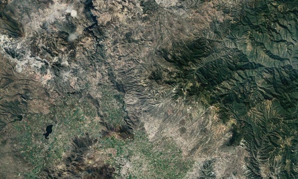
Synthetic aperture radar (SAR) satellites are some of the most powerful tools available for armed forces wanting to locate the enemy and decide on an engagement strategy. Orbiting the planet at an altitude of about 560 km, such systems are able to penetrate the darkness of night and see through thick cloud cover to produce clear images of military assets on any continent.
Up until very recently, access to this powerful technology was largely limited to the major military powers. But over the past five years, a significant change has occurred. A number of commercial SAR satellite companies have appeared, offering customers high-quality radar images of anywhere on the planet. A case in point is the Finnish company ICEYE which aims to deliver information on “every square metre of the Earth, every hour”. The company has more than 20 satellites in orbit and plans to have nearly 40 operational by 2024. The business and its competitors, including the US satellite company Capella Space, represent a game-changing shift for armed forces worldwide.
Low-cost images in hours
The reasons behind this rapid growth in commercial SAR satellites are reasonably straightforward. There has been a surge in the number of commercial space-launch services in operation in recent years, and this has seen the number of launches go up and the price to launch satellites come
down significantly. At the same time, the size of satellites has generally decreased, meaning multiple units can be deployed simultaneously. Meanwhile, demand for SAR images from sectors as diverse as agriculture, aquaculture and firefighting has made it profitable for private companies
to invest in the technology.
Unlike “real aperture radars”, where resolution is limited by the length of their antennas, SARs have relatively short antennas. However, the use of algorithms allows them to combine multiple small images and produce highly detailed composite pictures of sections of the planet’s surface. For a few thousand US dollars, anyone can purchase an image from a commercial SAR satellite business, showing a 5 km2 area of the Earth with a resolution of 0.5 m. The image is often delivered within a couple of hours of it being taken, and follow-up images of the same site can be ordered to monitor changes. While SAR systems in general are not particularly effective at identifying human beings, they are excellent at pinpointing metallic assets. For military uses, this includes platforms such as trucks, tanks and aircraft.
Nowhere to hide
The repercussions of this explosion in commercial SAR satellite data are significant for armed forces wanting to conceal their assets, movements and strategic intentions. As more and more SAR satellites come online, it is becoming progressively harder to avoid detection. While the resolution of
the commercial radars may not be quite as good as military-grade radars, they are good enough to allow analysts to draw conclusions about what the enemy is doing. By comparing one image with the next, the movement of
equipment in and out of an area can easily be discerned.
What’s more, armed forces can expect the sensor threat to continue growing rapidly. As new companies come onto the market and the number of SAR satellites increases, covering more of the planet, a time is approaching when it may be possible to have live SAR video of an area. While in the past, armed forces could hide sensitive assets in hangars when they knew the enemy’s radar satellite was approaching, that is no longer an option.
Camouflage solutions
Deceiving the enemy about one’s true intentions and movements is key to battle success. This is why it is crucial that armed forces pivot to address the sensor threat. While the commercialisation of SAR satellite systems makes it harder to hide assets, it is still possible. To do this, armed forces need to choose camouflage systems that are effective against SAR and also need to think strategically about the best ways to use them.
Saab’s Barracuda systems aim to combat radar sensors using absorbers that attenuate the electromagnetic pulse emitted by SAR satellites, concealing the assets hidden beneath. Field trials have clearly demonstrated that if these systems are used correctly, it is extremely difficult to spot camouflaged assets. When this kind of system is combined with decoys that make the enemy look elsewhere, a very high degree of deception can be achieved.
The conflict in Ukraine has demonstrated the importance of supply chains for battle success. Camouflage solutions aimed at defeating SAR satellites should do more than just cover battle assets like tanks and troop carriers. It is critical they cover the full logistic chain as well, including fuel, ammunition and food trucks. If a country’s armed forces are operating with international allies, it is also vital that all the forces have good deception and camouflage capabilities. Otherwise, the weakest link will lead the enemy directly to the group.
The added optical threat
Meanwhile, attention should also be paid to the continued growth of commercial optical satellite services. Following a boom in the early 2000s,
such services now provide anyone with a credit card with detailed visual images of anywhere on the planet. One shortfall is that they lack the flexibility and 24/7 operation of SAR images. Being passive systems, they rely on reflected daylight to create an image, meaning they cannot produce usable images at night or if clouds are obscuring the target area. However, objects also tend to be easie to identify in visual format. An object that “might be” a truck when viewed in a SAR image can often be clearly´identified as “definitely” a truck with an image from an optical satellite. When SAR and optical satellite images are used together, they represent a formidable, round-the-clock sensor threat that no armed forces can ignore. There are now plans underway for various satellite companies to work
together to launch constellations of optical and SAR sensors to achieve such coverage.
Hyperspectral on the horizon
Looking ahead, the next challenge for armed forces aiming to conceal their
actions from the enemy is likely to be the arrival of commercial hyperspectral satellites.
Advanced hyperspectral scanners are currently used by major military powers and provide highly detailed images of targeted areas when compared to conventional technologies. An electromagnetic spectrum is assigned to each pixel of an image, allowing the sensor to differentiate between natural and man-made materials and easily identify objects of military significance.
Currently, there are no hyperspectral scanners commercially available, but there are plans for a commercial service to begin operation soon with a constellation of satellites. This represents the next major sensor threat for camouflage systems to overcome, as hyperspectral scanners can differentiate between a surface that has been painted green and vegetation which is the same green.
While the threat is real, camouflage developers such as Saab are already working on camouflage solutions with the potential to fool the sensors. We have had hyperspectral technology in-house for several years and our teams have been hard at work developing systems to counter it – some of which are at the prototype stage. Generally speaking, camouflage tends to lag a little behind sensor development. But once a sensor is in the market, it doesn’t take long for our teams to develop a camouflage system to defeat it.
Camouflage solutions
More about Johan Jersblad
Johan Jersblad
is a Senior Development Engineer specialized in Signature Management at Saab. He joined Saab in 2003 working with radar absorbing materials for ground vehicles. Today, he is working with Signature Management in the whole electromagnetic spectra, from UV to RADAR. Focus is both on material development and measurement methodology. He participates in numerous international collaborations focused on Signature Management within both NATO and EDA. Jersblad holds a Ph.D. in Laser Cooling from Stockholm University.